GREENLAND
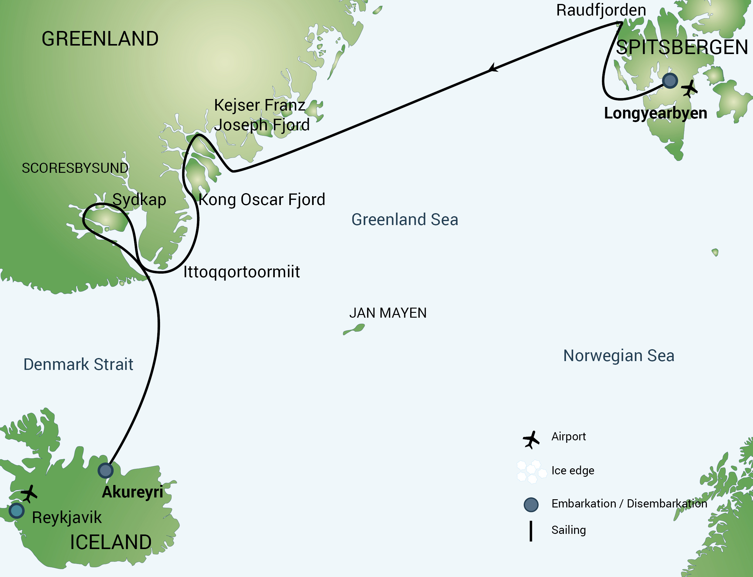
Spitsbergen - Northeast Greenland
longyearbyen, Svalbard TO Akureyri, Iceland
Once every four years James Cresswell will take an exclusive GeoWorld Travel group, onboard a passenger expedition cruise ship to Greenland
Next trip: 2026 - dates TBC
*Minimum GeoWorld Travel group size is 6*
14 Days/13 Nights
Price from €TBC
East Greenland is a truly awe-inspiring destination. There is an almost complete sedimentary succession stretching back for the last 1.5 billion years. Due to the incredible completeness of this record, many of the Earth’s most important stories can be seen on this trip. On top of this the story is set in jaw-dropping scenery, with attractions including the Northern Lights, wildlife such as the polar bear, and the Inuit culture. Key geological features that can be seen on this trip include three billion-year-old basement rocks, 1,900 m high stripy cliffs formed from 900 million-year-old sediments (as shown in our website banner above), Devonian sandstone where the famous fossils that link the amphibians to fish were found, Mesozoic rocks that have revealed dinosaurs and ammonites, columnar basalt in the lava flows from the splitting of the Atlantic, and amazing icebergs and glaciers.
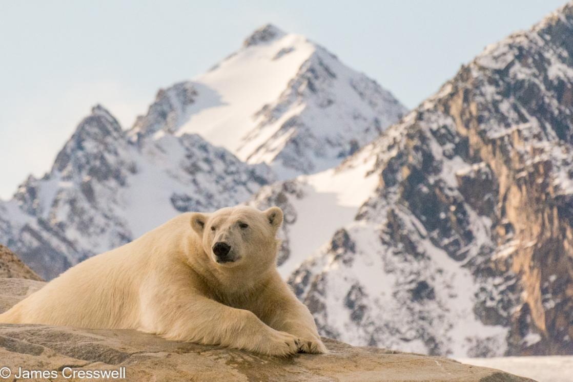
A polar bear in northwest Spitsbergen. The first day of the tour is the best chance of seeing a polar bear as they are rare in east Greenland.
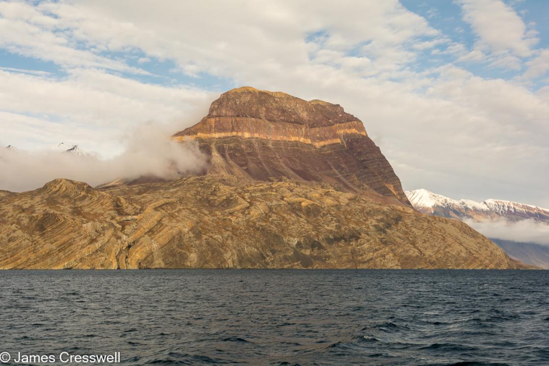
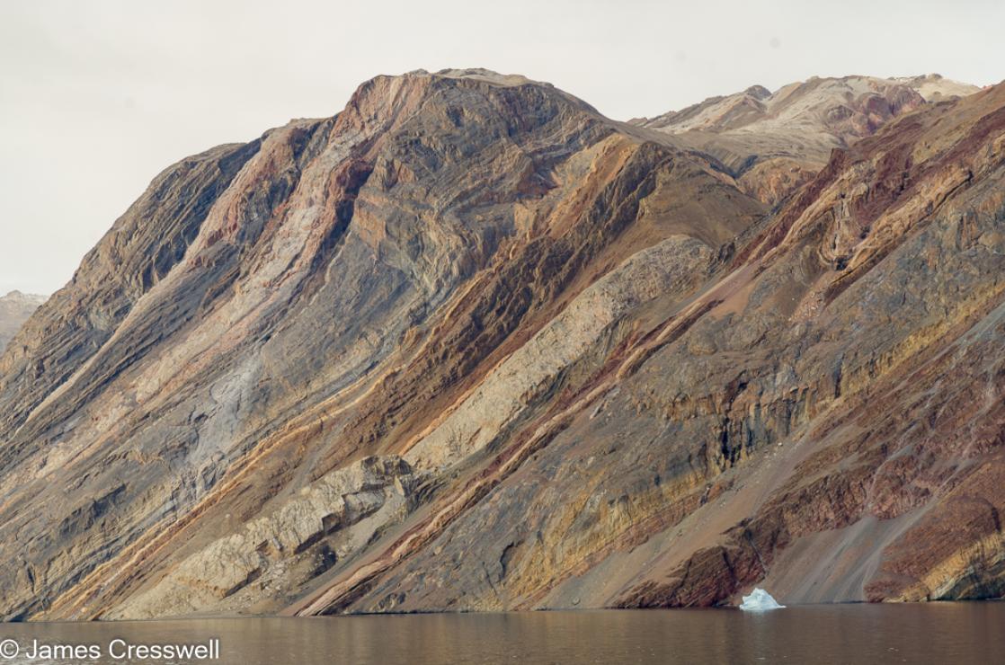
Teufelschloss (Devil'sCastle) in Kejser Franz Josef Fjord. The sedimentary rocks layers are part of the Eleonore Bay Formation.
Eleonore Bay Formation sedimentary rock layers in Antarctic Sound
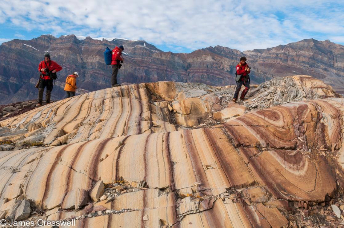
A landing in Segelsällskapets Fjord, with Berzelius Bjerg Mountain in the background. The people are standing on folded brown and white dolomite layers.
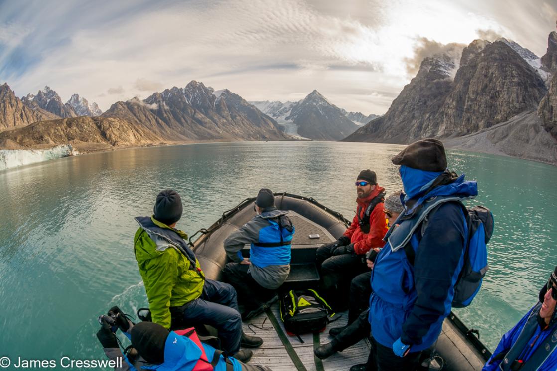
A zodiac cruise in Alpefjord
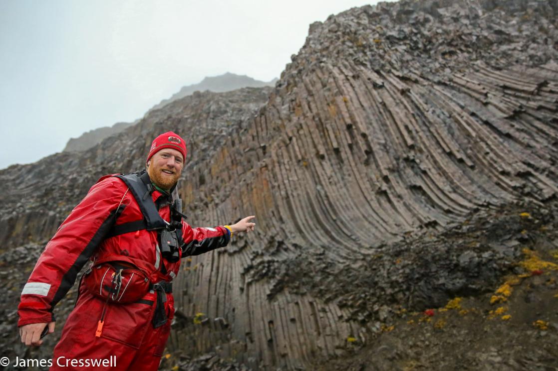
James Cresswell pointing to columnar basalt in Viking Bugt
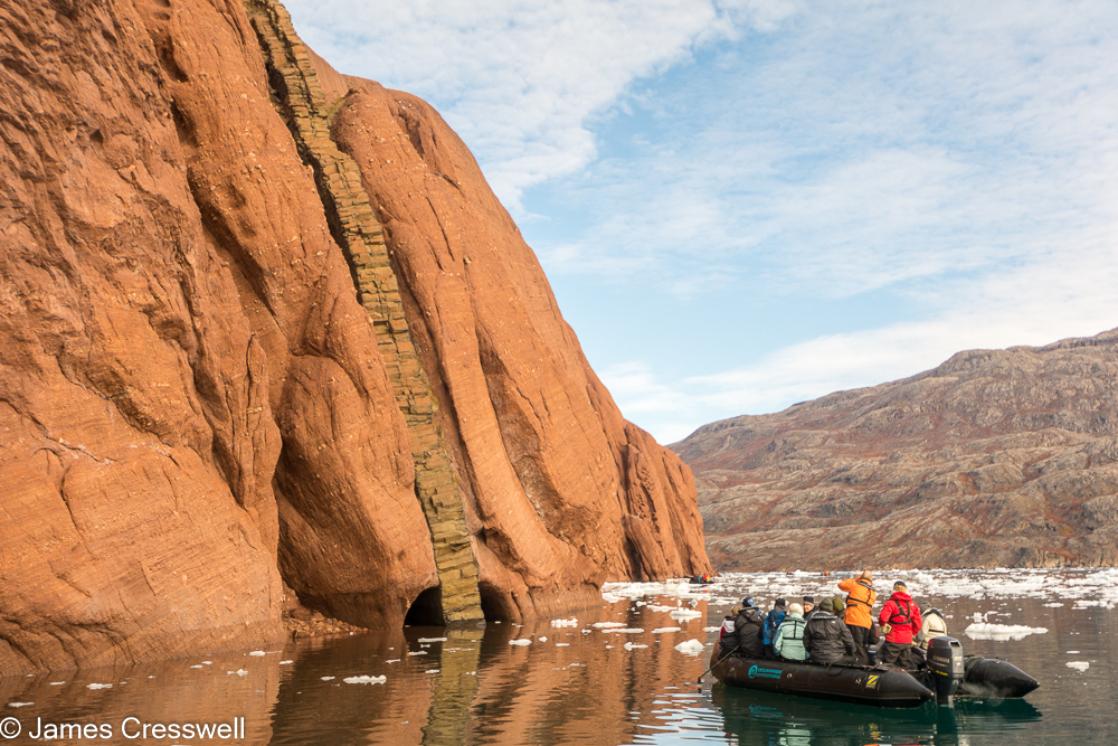
A zodiac cruise off Røde Ø, here a Paleogene basaltic dyke cuts through bright red Carboniferous-Permian aged sedimentary rocks.
Grundtvigskirche in Øfjord
Ittoqqortoormiit also known as Scoresby Sund is the only settlement in northeast Greenland
Possible Itinerary
PLEASE NOTE: The probability of sailing into Scoresbysund is high (based on our experiences from 1993 – 2019), but there is still a chance (about 10%) that ice will obstruct passage into the fjord system. All itineraries are for guidance only. Programs may vary depending on local ice and weather conditions and in order to take advantage of opportunities to see wildlife. The on-board expedition leader determines the final itinerary. Itineraries may mention places that require permission to land, which must be granted by the relevant national authorities. Such permission is not granted prior to the publishing of these itineraries. Flexibility is paramount for expedition cruises. Average cruising speed for the ships is 10.5 knots.
Day 1: Largest town, biggest island
You touch down in Longyearbyen, the administrative centre of Spitsbergen, the largest island of the Svalbard archipelago. Enjoy strolling around this former mining town, whose parish church and Svalbard Museum make for fascinating attractions. Though the countryside appears stark, more than a hundred species of plant have been recorded in it. In the early evening the ship sails out of Isfjorden, where you might spot the first minke whale of your voyage.
Day 2: Route to Raudfjorden
Sailing to Raudfjorden, on the north coast of Spitsbergen, you take in an expansive fjord spilling with glaciers – and maybe even visited by ringed and bearded seals. The cliffs and shoreline of this fjord also support thriving seabird colonies, rich vegetation, and the possibility of polar bears.
Day 3 – 4: Onward to east Greenland
You may eventually see the jagged edge of the east Greenland sea ice flashing into sight ahead, depending on the conditions. Keep watch for whales and migrating seabirds here.
Day 5: Tundra, mountains, and icebergs
As you approach Greenland, you may sail through the sea ice into Foster Bay and land at Myggebugten. Beyond the old hunters’ hut (where Norwegian trappers hunted for polar bear and Arctic fox in the first half of the 20th century), there is a sprawling tundra populated by musk oxen, with geese floating the small lakes. From here you sail through Kaiser Franz Josef Fjord, surrounded by towering mountains and bright interior icebergs. An alternate route is Sofia Sound, a narrower waterway.
Day 6: The islands of Antarctic Sound
You arrive at Teufelschloss (Devil’s Castle), a mountain with layered geology. On the other side of the fjord is Blomsterbugt and the intended landing site. In the afternoon you head into Antarctic Sound, where you find the islands of Ruth, Maria, and Ella. Maria is the most likely spot for a landing.
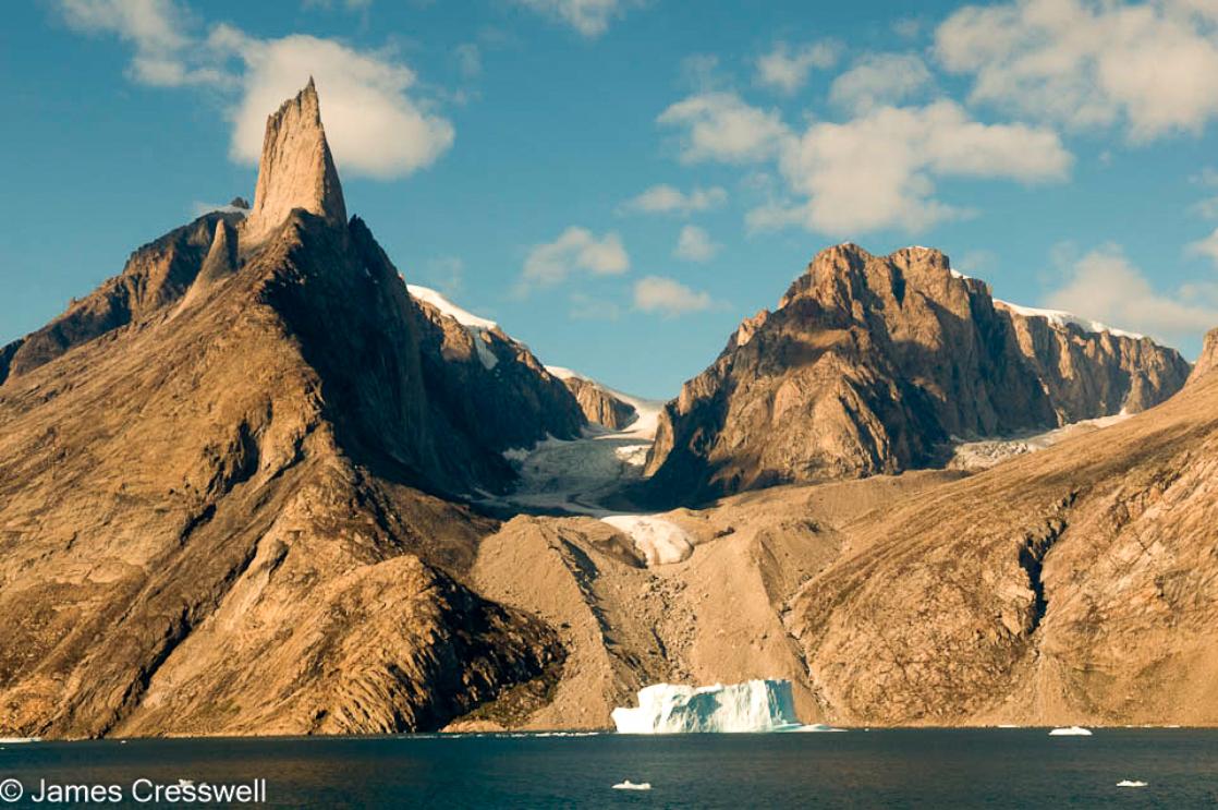
Day 7: Alpefjord’s lofty peaks
In the morning you enter Segelsällskapets Fjord, with the streaked slopes of the Berzelius Mountains bordering the north side. You land on the south shore, where ancient sedimentary formations lie right at your feet. A hike takes you near a small lake with good chances to see musk oxen, Arctic hares, and ptarmigans. In the afternoon the ship ventures into Alpefjord, aptly named for the spire-like peaks that thrust up around it. You may then embark on a Zodiac cruise around Gully Glacier, which once blocked access to the interior of these waters. Continuing deep into the fjord, you experience a definitive Greenland adventure.
Day 8: Sights of the Arctic autumn
The first half of the day you spend in Antarctic Havn, an extensive valley where you can spot groups of musk oxen. At this time of year, the sparse vegetation is dressed in the fiery colors of autumn.
Day 9: Inuit neighborhood of yesteryear
Today you reach Scoresbysund, sailing along the glaciated Volquart Boons Kyst. You may also enjoy a Zodiac cruise past one of the glacier fronts, along with a visit to the basalt columns and ice formations of Vikingebugt. The afternoon goal is to visit Danmark Island, where you find the remains of an Inuit settlement abandoned around 200 years ago. The circular stone tent rings indicate the summer houses, while the winter houses can be seen closer to a small cape. The sites are well preserved, with easy identifiable entrances, bear-proof meat caches, and grave sites. In the evening, you continue sailing the berg-crowded fjords to the west.
Day 10: Colours of the cape
The goal is a Zodiac cruise near Røde Ø, one of the world’s most cherished iceberg attractions: The austere blue-white of the icebergs sets sharp against the brooding red backdrop of the sediment slopes. The afternoon plan is to sail through the northern parts of Røde Fjord, with the chance to see musk oxen and warm autumnal foliage.
Day 11: Enormous bergs, Arctic hares
In the morning you encounter colossal icebergs, some over 100 meters (328 feet) high and more than a kilometre (0.62 mile) long. Most of them are grounded, as the fjord is only about 400 meters deep (1,312 feet). You then land near Sydkap, with fine views of Hall Bredning and a good shot of seeing Arctic hares.
Day 12: Settlement at Scoresbysund
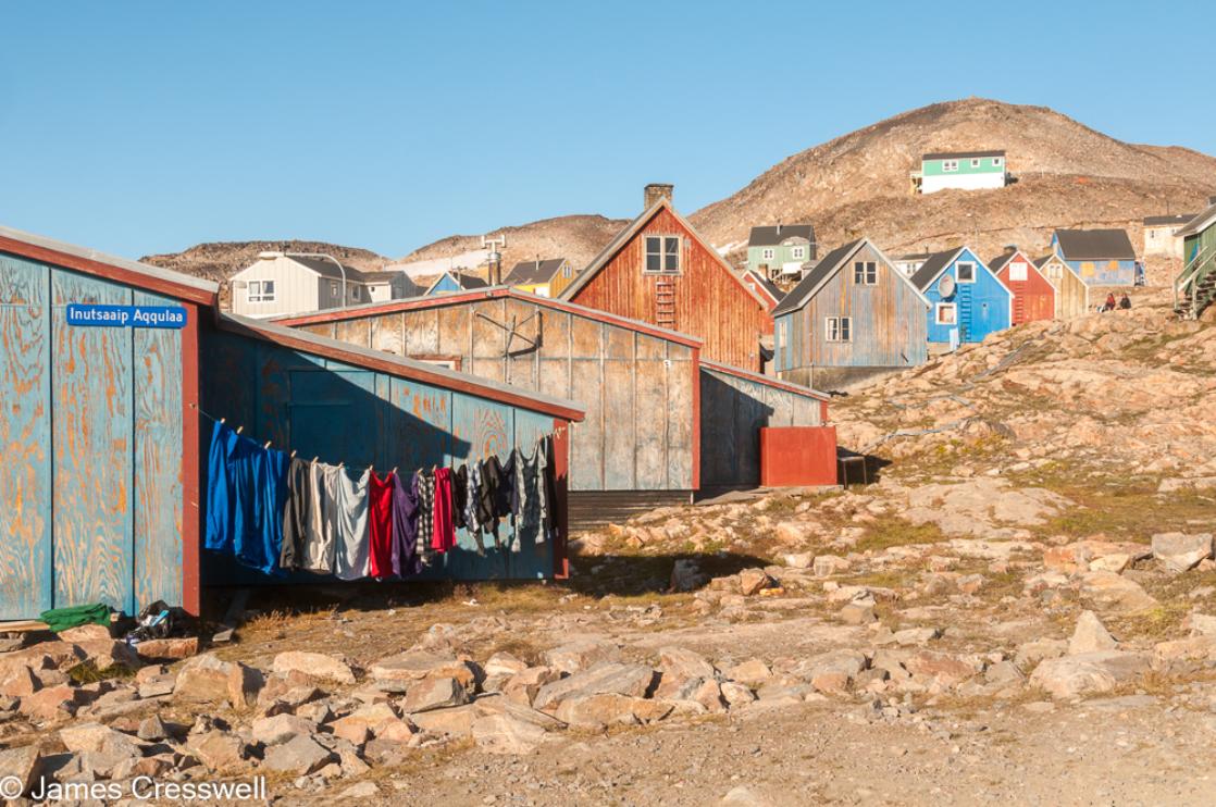
Today you make a tundra landing on Liverpool Land, in Hurry Inlet. The afternoon stop is Ittoqqortoormiit, the largest settlement in Scoresbysund at about five hundred inhabitants. At the post office you can buy stamps for your postcards, or just stroll around to see the sled dogs and drying skins of seals and musk oxen. In the afternoon you sail south, passing the picturesque landscapes of the Blosseville Coast.
Day 13: Sea life under the northern lights
A sea day grants you the opportunity to spot whales and seabirds – and at night, the magical northern lights.
Day 14: Journey’s end at Akureyri
Every adventure, no matter how grand, must eventually come to an end. You disembark in Akureyri, where on request you can transfer (T) by chartered bus (a six-hour drive that you must book in advance) to the Reykjavik city hall, taking home memories that will accompany you wherever your next adventure lies.
INCLUDED
Geological guiding from James Cresswell
Guiding from other ship based experts
All meals and accommodation on the ship
NOT INCLUDED
Flights
Transportation to and from the ship
Drinks on the ship
Wifi data on the ship

Reviews
GREENLAND - SPITSBERGEN-NORTHEAST GREENLAND (2023)
"This was my first geology trip, and even more pleased that it was to Greenland as a part of the GeoWorld Travel group! James was so passionate and knowledgeable about the geology in Greenland, that his enthusiasm was infectious. Being an amateur in geology, I could easily follow his explanations about the geological formations we saw at the various fjords. The handbook which he compiled for the Group was excellent as it helped to better shape my understanding and context of what I was viewing at the sites. By the end of the trip, I was not only able to identify garnets but also could identify the time periods of the different rocks I could see. So a BIG thank you from me James - and looking forward to my next trip!"